
Fushimi Inari: Short Torii Walk or Summit Route?
Choose a Fushimi Inari visit that fits your Kyoto day: the main shrine and Senbon Torii, a flexible uphill walk, or the full sacred mountain route this autumn.
Guides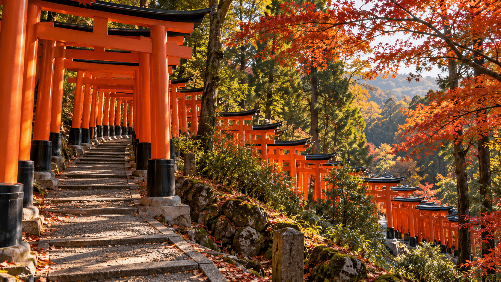
At a glance
- Visit options
- Senbon Torii
- Closest JR stop
- Inari Station
- Mountain height
- 233 metres
Fushimi Inari Taisha — Fushimi Inari Taisha
Kyoto's autumn planning question at Fushimi Inari Taisha is deceptively simple: should you stop after the famous red gates or keep climbing the sacred mountain? The shrine's own map shows that Senbon Torii is only one part of a much larger precinct. The right choice depends on whether you want a short shrine visit, a walk with a clear turnaround point, or time to follow the mountain's worship route. Decide before you join the flow uphill, because a photograph of the first torii corridor and a visit to Inariyama are different experiences.
What does each version of the visit include?
The shortest meaningful visit starts at the Romon gate and main hall, then continues through Senbon Torii to the Okusha Hohaisho worship place. This takes in the architecture, the densely spaced gates and a place where worship continues. It does not require you to treat a mountain ascent as an obligation. The shrine explains that Fushimi Inari Taisha is the head shrine of Inari worship and that Inariyama itself is part of its sacred precinct. Those facts make a short visit legitimate: you are at a living shrine, not merely at the trailhead of a scenic walk.
A longer visit continues beyond the first famous corridor toward Kumatakasha and the mountain paths. The shrine's Inariyama description identifies three peaks, named Sannomine, Ninomine and Ichinomine as you move from the peak nearest the main shrine toward the farther peak. Along the route are smaller worship sites and stones engraved with deity names. A full mountain circuit therefore changes the subject of your outing. You move from seeing the best known gates to encountering a distributed place of worship. If you want only the visual corridor, climbing to the top will spend time without necessarily answering a different question.
The sensible middle option is to walk upward until you reach a point where your group can calmly choose whether to continue. Use the shrine map and signs on site as the authority for the path and your return. Do not take an unsourced online estimate as a promise about your own walking time. Crowding, photo stops, weather, stairs and the ability of the slowest walker change the timetable. An itinerary with a train or timed booking later in the day should set a latest turnaround time before starting.
Is the summit the best reward?
The mountain is sacred rather than a conventional observation deck. The official explanation places Inariyama at 233 metres above sea level and describes its peaks, former shrine sites and many worship stones. Reaching a higher point matters if the route, the quiet between sites and the religious landscape are the purpose of your visit. It is less essential if the goal is to recognise the torii gates from photographs, see the main shrine and continue to another Kyoto neighbourhood. Treat the summit as a deliberate choice, not a test of whether you have “done” Fushimi Inari.
There is also no need to race through worship areas to make a theoretical ascent target. The shrine says torii gates have been donated as offerings of prayer and appreciation since the Edo period, and its Senbon Torii explanation gives that custom the context missing from many quick travel photos. The gates are not identical stage scenery. Slowing down to understand why the approach is lined with offerings can give a short visit more meaning than a rushed walk to a higher marker.
For a traveller who likes long walks, the choice is easy: reserve a substantial block of your day, wear shoes suited to steps and uneven paths, and leave room for a slower descent. For a party with children, limited mobility, tight onward plans or a strong preference for cultural rather than physical activity, the lower precinct and the first gates may be the better visit. This is a planning judgment, not a claim that a particular section is universally accessible. Conditions vary; judge the ground in front of you and turn back when necessary.
How should you arrive?
The shrine's official access page points visitors to public transport because roads and parking around the site become crowded. It places the JR Nara Line's Inari Station immediately by the shrine and Keihan's Fushimi-inari Station about a five minute walk to the east. The JR line is a natural option if you start at Kyoto Station; Keihan can make more sense if your previous stop lies along its line. Choose the route from your actual previous location rather than treating a single station as mandatory for every visitor.
Make your return station part of the plan too. A round trip to the same rail line is simple, but a visit can also end with a different Kyoto stop. Confirm the service and the station on the operator's live journey planner. If you are travelling with a group, agree on a meeting point before entering a busy corridor where one person may stop for photos while others continue uphill. A downloaded map or saved station name is useful if mobile data is weak; it does not substitute for local signs.
Roameo sells travel data rather than operating the railway or the shrine. If your phone supports eSIM and your trip needs mobile data for maps or onward train checks, compare the current destination plans and their coverage before departure. Keep the shrine map available offline as a second route reference. No mobile plan can make a crowded path, a closure or a missed train disappear.
A workable autumn morning
Imagine two travellers staying near Kyoto Station with a lunch booking elsewhere. They take the JR line to Inari Station, visit the main shrine, walk through Senbon Torii and continue only while their agreed turnaround time allows. One traveller wants photographs; the other wants to understand the worship route. They can pause at the lower sites, consult the official map and decide together whether a further climb would risk their lunch booking. The plan succeeds even if they do not reach a summit marker, because their actual goals were the shrine, the gates and a comfortable onward journey.
Now imagine a second pair whose principal Kyoto activity is the Inariyama walk. They set aside most of their morning, carry drinking water, start without a fixed early appointment and pay attention to the path. Their reward is the sequence of gates, stones and worship places across the mountain. They should still turn around if weather or fatigue changes the plan. The distinction between these two itineraries is time protected for the walk, not a magic entry ticket or an exact minute estimate.
Respectful conduct changes the route
Fushimi Inari Taisha has published a request for all visitors that is worth reading before walking uphill. It prohibits entering restricted areas, damaging gates or trees, smoking or making fires, and eating or drinking while walking or standing outside marked rest areas. It also asks visitors not to obstruct worshippers by filming on narrow paths. These rules have a practical effect: a photo stop must leave space for others, and a snack break belongs in an allowed rest area rather than in the middle of a torii corridor.
The same notice restricts commercial photography and certain other activities. Travellers carrying professional equipment should not assume an ordinary visitor's photo permission covers a commercial shoot. If a planned activity is more than personal sightseeing, ask the shrine first. The calmest visit is often the one that accepts a busy lower path, takes a few careful pictures and moves aside for worshippers. Going farther uphill does not grant a special exemption from the shrine's rules.
How to make the final choice
Choose the lower precinct and Senbon Torii if you have little time, limited walking capacity, or several Kyoto commitments the same day. Continue into the mountain if you want the walking route and can protect the time to return comfortably. Use a middle turnaround if you want some of each and can decide without pressure. In all three cases, start with the shrine's map, arrive by a suitable rail line, and leave the route clear for worshippers. That is a more useful decision than an unsupported promise that every visitor must complete a particular circuit.
Frequently Asked Questions
Do I have to reach the top to see Senbon Torii?
No. Senbon Torii is shown near the main shrine on the official map. The mountain route continues beyond it.
Which station is closest to the shrine?
The shrine lists JR Inari Station immediately by the site and Keihan Fushimi-inari Station about five minutes away on foot. Choose according to your previous and next stops.
May I stop for a photograph inside the gate corridor?
Personal photography should not block worshippers or the narrow path. Follow the shrine's posted requests and move aside rather than holding up the flow.
Keep reading
Taiwan Palace Museum: Northern or Southern Branch?
The National Palace Museum has branches in Taipei and Chiayi. Compare their locations, 2026 tickets, hours and transfers before choosing a museum day.
Read more
Changdeokgung Palace or Secret Garden: What to Book?
Changdeokgung main palace and Secret Garden need separate admission. See the official 2026 prices, reservation window, autumn capacity and booking rules.
Read more
Oslo Airport Flytoget or Vy: Which Train Fits?
Compare Flytoget and Vy from Oslo Airport by the next departure, your hotel station, ticket rules and the current official express fare before buying a ticket.
Read more